Day 1: Drass
Day 2: Kargil – Batalik Sector
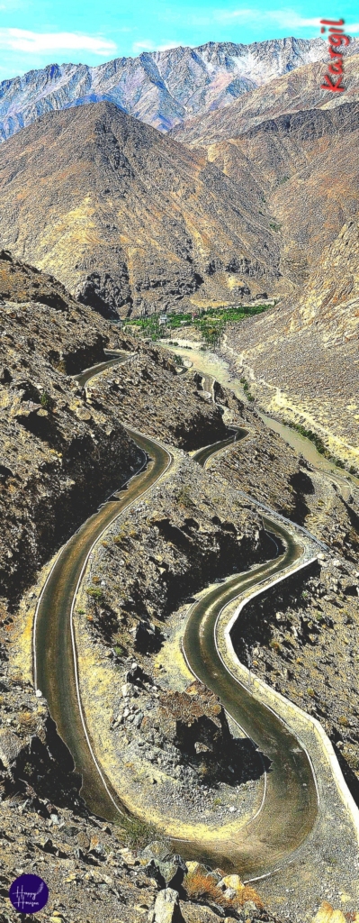
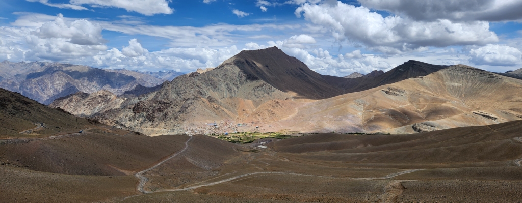
Kargil – Hundarman – Hambuting La – Darchik – Lamayuru: 155 km. / 4 – 5 hr. / Altitude 11,500 ft. (Lamayuru)
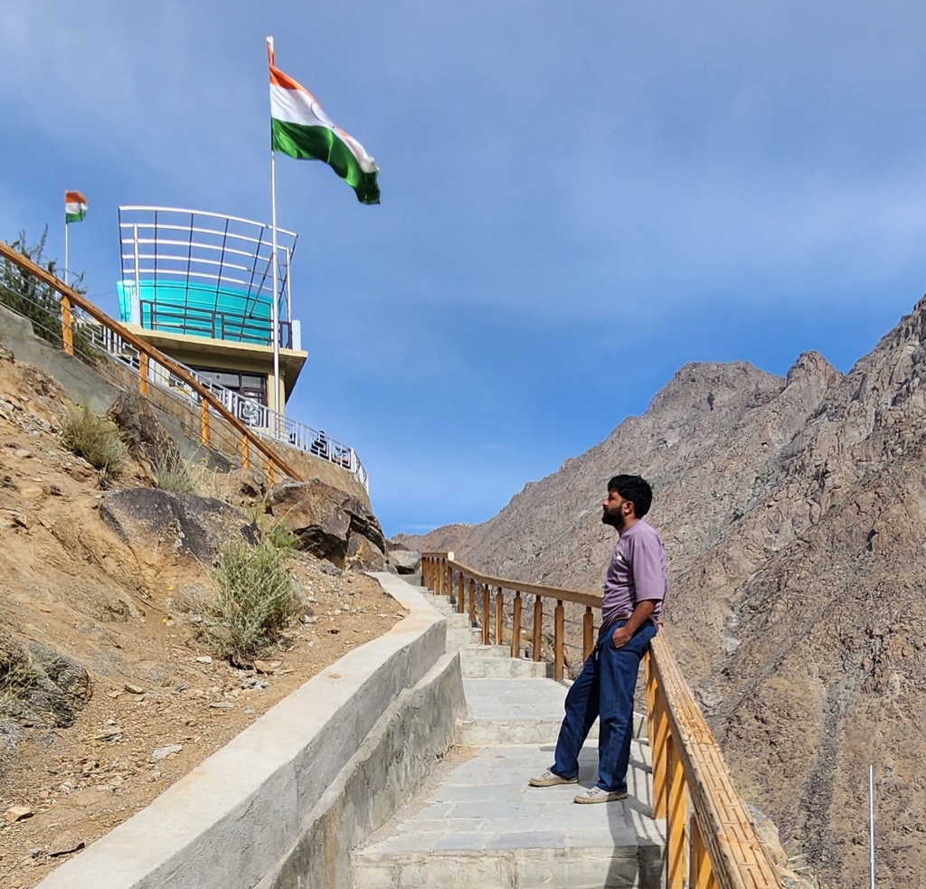
LOC Viewpoint @ Hundarman
We had an early morning schedule to visit Hundarman village. Its the last village on the LOC on this part of the country.
We quickly had our breakfast. Shahid was on time and he was waiting for us to ferry us to the Hundarman village. The car ride in age-old Omni was quite a joy ride. Shahid turned out to be a native of Khabroo. He said that he had seen us in the village the previous evening. Danish and Shahid bonded together immediately over Dardi connection.


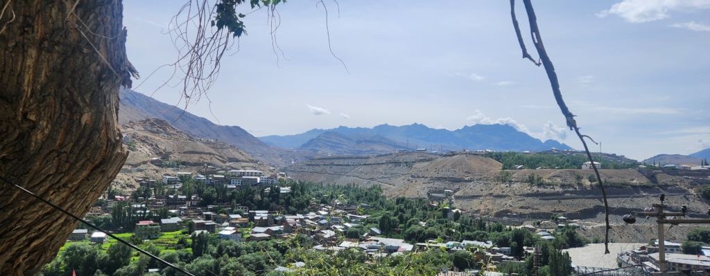
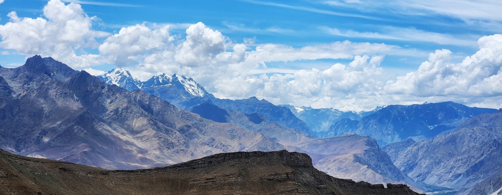
As we gained height we could see the entire Kargil town and river Suru meandering around the hills after merging with river Drass. Drass river joins Suru further about 7 kms. north of Kargil, which then enters POK and merges with Indus river.
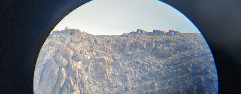
We quickly reached the LOC viewpoint constructed by the tourism department with a small cafeteria. From this point, the guide directs you to the LOC faraway and Pakistani army bunkers across the border.
The guide, for a small charge, lends his binoculars to have a clearer look. After experiencing LOC at Keran and Tithwal from such close quarters, watching Pakistani village tucked faraway across LOC through binoculars was neither a get adventure nor excitement for me personally. Nevertheless, it gave me an insight about the topography and challenges of military to safeguard borders.
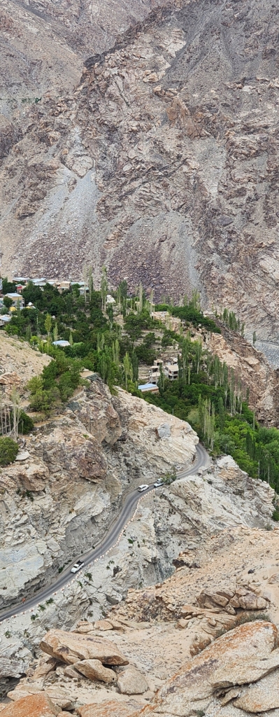
Hundarman Village
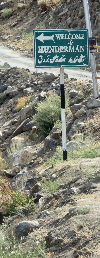
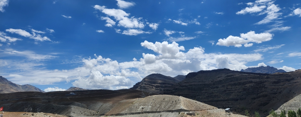
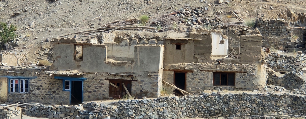
We quickly wrapped up visit to the viewpoint. The next destination was Hundarman village. Shingo River flows along the village. Shahid showing us a patch of road, explained that the said road was the ancient Silk Route, also called the Skardu–Kargil road. One could reach Skardu within 5 hours drive from Kargil. As we travelled through the area, I noticed that there was hardly any settlement around the area. Shahid said that there are still uncleared land mines planted by Pakistan along the foothills, which deter people.

Shahid said that post India’s partition in 1947, Hundarman came under the control of Pakistan. However, Hundarman village came back under India’s control post the 1971 India-Pakistan war. Hundarmo Brok, as it was called, became Hundarman and it became part of Kargil district. Since the end of the war, India continues to retain control over the region – mostly mountains, ranging in height from 18,000 to 23,000 ft. Hundarman is one of the villages that has faced the trauma inflicted by an uncertain border. It has witnessed several wars and been part of two nations. As the borders along the LOC has shifted, homes and families have been torn apart.
Shahid explained that the people of Hundarman, a typical village in Kargil district, had lived under the whimsical reign of the LOC. The lives of many villagers have been destroyed by its fury. Yet, the LOC has also become the source of livelihood, due to influx of tourists to have first hand experience of life near LOC. The other most popular profession for the villagers is of a porter – to ferry supplies to the army at high altitudes from Kargil town. Shahid jokingly said that the region remains the same, the porters and mules are the same, loyalty to profession remains, but only the pay-masters have changed – apart from their so-called nationality. However, Shahid acknowledged that most of the people are happy on the Indian side.

Shahid said that if we would talk to the villagers, every home in the village would have a sad story where the families have been separated due to overnight change in the LOC. People who had been travelling for business or visiting their extended families on either side of the LOC first got stuck in 1947 and then again in 1971. He had many stories of his friends to narrate, which moved me and think that fate is an unacknowledged casualty of war.
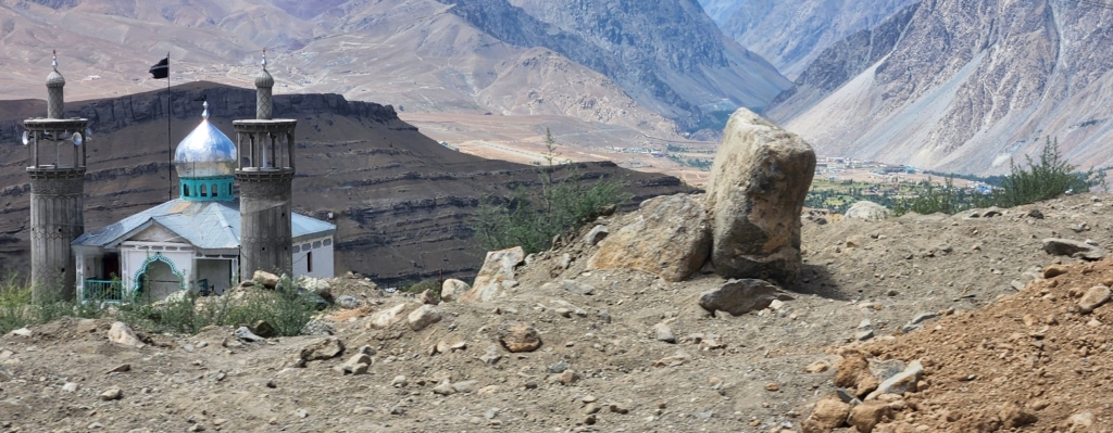
As we reached the Hundarman village, a wooden board near the village reads:

“Unlock Hundarman (Museum of Memories), an abandoned Purgi settlement in Kargil located at the LOC, came under India post the 1971 India-Pakistan conflict. The rediscovery of the settlement in the form of artefacts and memories demystifies its dominant narrative as a war-ridden village”.
The board also reveals that the “Hundarman – Museum of Memories” project is a collaboration between Roots Collective (a non-profit organisation based in Kargil) and SWS CEPT University, Ahmedabad, to preserve the history, culture, and memories of the border settlement through oral narratives and recovered artefacts.
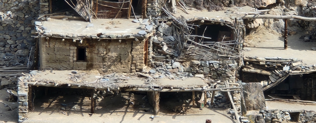
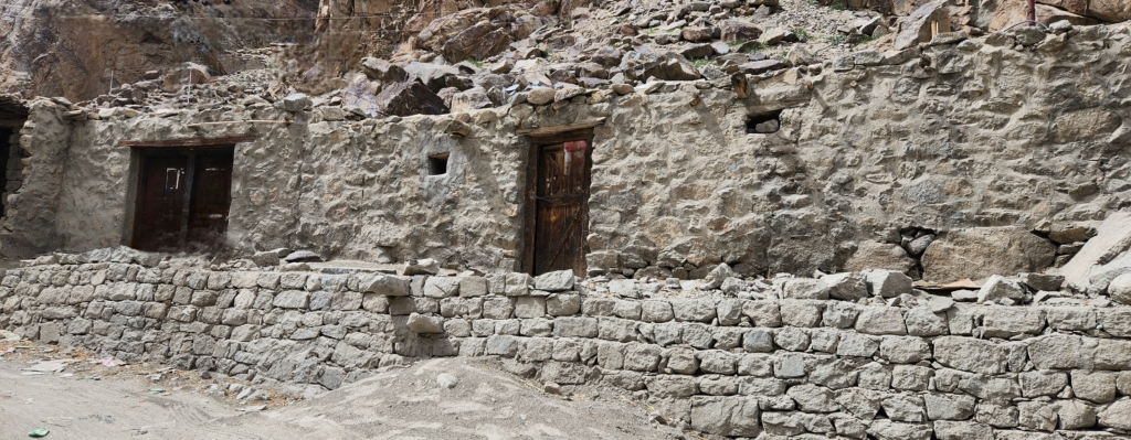
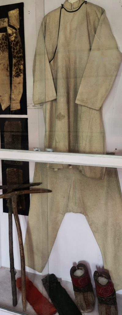
The museum displays the old kitchen utensils, traditional jewellery, indoor games, family documents, letters to armaments from the wars. The museum is managed by a local resident who works as a contract labourer in the village fields. If you need to explore the museum, you need to catch him early morning before he sets off to earn his daily wage. We missed him.
It is said that Hundarman is a 500-year-old settlement. Its inhabitants, are said to be older than the Mughal and British empires. The current houses itself are said to be more than a hundred years old, constructed over time. The houses are constructed in such a manner that the roof of one house appears to be the floor-base of the other above it. Probably, the first sky-scrapper of its time.

Line of Control (LOC)
As I write about Hundarman, curiosity has taken over me to explore the brief history about LOC. As I researched about relative positions of the two nations with regard to LOC, I am also driven to provide my analysis, rightly or wrongly.
Fact: Post-partition in 1947, a short war followed over Kashmir. Thereafter, an agreement was signed in Karachi (the “Karachi Agreement, 1949”) by the military representatives of India and Pakistan, supervised by the UN, which established a cease-fire line in Kashmir.
The cease-fire line, about 750-800 km., started from village Dhalan, a southernmost point just west of the Chenab river near Jammu and it runs in a rough arc northwards and then north-eastwards to a coordinate NJ9842. The NJ9842 point is about 20 km. north-east of the last Indian village Thang (Turtuk) on Shyok river.
The NJ9842 point is on the Saltoro mountain range that runs north from the village of Chalunka. The NJ point is not a longitude – latitude co-ordinate on a map but a location based on Indian Grid Coordinates and is represented in full: NJ 38 98000, 13 42000.

Since there were no troops beyond NJ9842 due to inaccessible glacial terrain, no effort was made to extend the ceasefire line between NJ9842 and the international border. This strategically important area – Siachen Glacier, eventually became the highest battle ground between India and Pakistan. From NJ9842 point, LOC was said to run “thence
north to the glaciers”, at a distance of about 60 – 75 km.
At the end of the 1971 war, India and Pakistan agreed to rename the ceasefire line as the “Line of Control” and LOC was established as part of the Shimla Agreement. Apart from minor details, the line is roughly the same as the original cease-fire line of 1949. LOC is a military control line which does not constitute a legally recognized international boundary. Both nations pledged to respect it.

My Analysis: Please take my analysis, with a pinch of salt as I am not a professional political / military analyst, but my views hereunder is based on extensive travel along the borders areas (LOC) of Kashmir and Ladakh, and discussions with the locals.

It’s apparent that the military conflict initiated by Pakistan with the help of local lashkar’s to annex entire region of Kashmir and Ladakh, just months after partition, seemed like a well thought-out and co-ordinated plan.
As India’s army was brought insignificantly later, the army’s first priority was primarily of containment and push-back of the aggression in the region. Under then prevailing infrastructure the Indian military success was commendable.
In hindsight, the decision to pull back the army after overpowering Tithwal, redirecting forces toward Poonch rather than advancing on Muzaffarabad, may have been a critical misstep. While I am not privy to the circumstances that influenced this decision at the time, securing Muzaffarabad would likely have strengthened the Indian Army’s foothold in the entire Gilgit-Baltistan region. This could have shifted the cease-fire line (LOC) northward up to the Babusar Pass in Gilgit, rather than extending it eastward from Tithwal, potentially altering the strategic landscape significantly.
Probably, a decision made in naivety or decision made by the establishment at the back of J&K regional map not readily available on its table to react strategically. On hindsight, it may have been an easy decision to follow the cease-fire line along the Kishanganga River flow and losing the battle of Skardu, also did not help.
LOC has cut through Indus River (near Batalik) and Shyok River (at Thang near Turtuk), so it could have happened at Tithwal too.
Amidst ongoing UN negotiations and border conflicts, pinpointing the exact timeline or details of how the cease-fire line was agreed upon remains challenging. What is evident, however, is that India approached the negotiations with a stance of elder brotherly guidance, striving for resolution with a sense of responsibility and leadership.

As an example “Operation Bison” was on-going in 1948 post eviction of Pakistan-led lashkar in 1947. India had all the reasons not to show any leniency to respect the proposed cease-fire line.
If the cease-fire line or LOC was extended upto Gilgit instead eastwards towards Point NJ9842, we would have been in much better position strategically. We would have not lost the Shaksgam valley, which Pakistan ceded to China in 1963, which would probably also have resisted China to annex Aksai Chin area. More importantly, Pakistan would not have made attempts to capture Siachen either.
Alternatively, India’s decision to relinquish the Gilgit-Baltistan region as part of the cease-fire line negotiation may have been influenced by the fact that the area was deeply entrenched with radical religious factions. Integrating such a volatile region into mainland India could have posed significant challenges and led to unforeseen collateral consequences.

Although these are irrevocable decisions but my endeavour has been to understand the thought process to draw the cease-fire line. It’s an ongoing investigation at my end, and will keep this post refreshed with new information.
Probably, I will move this section to a separate post, putting together cease-fire line, LOC, AGPL, Operation Meghdoot, Operation Rajiv and LAC.
Kargil – Town
On the way back, as we interacted with Shahid, we learnt that he was 29-years old and had recently married his school sweetheart. He and his wife both belonged to Kharboo, where they had grown up together. Shahid said that he had tough time collecting Rs. 1 lakh as “Mahr” for his nikkah, which was used towards marriage expenses. He has big family back in village with total of nine family members dependent on his income. We wished Shahid in his hard work and life in general, as he dropped us.
Back at the hostel we met Mubarak, which set us discussing history about Kargil. Mubarak said that the name Kargil is derived from two words “Khar” and “Arkil”, where Khar means palace and Arkil means centre.

Locationally this area has been in the centre of the territories of many dynasties. This is also proved by the fact that Kargil is located at a distance of about 200 km. from Srinagar, Skardu, Leh and Padum. With the passage of time Khar Arkil came to be known as Kargil. He added that in ancient time, the major part of present Kargil was named as Purig / Purik. A reference I had read in Hundarman village board.
Mubarak said that the Dards, Tibetans, and the Mongols of Central Asia are all ancestors of the present inhabitants of Kargil. Kargil since ancient times has been a place where multi-ethnic, multi-lingual, multi-cultural people have blended very seamlessly without any conflicts.
As Mubarak was narrating Kargil’s ancient history, I was enjoying listening to it. He said that geographically, Kargil was initially a part of the Baltistan. The famous king of Skardu in Baltistan, Ali Sher Khan Anchan, conquered most of the small kingdoms of Kargil (Purig) and introduced Balti culture in the region in 16th and 17th centuries.
The Dogras of Jammu again united Baltistan, Kargil, Zanskar and entire Leh district in the early 19th century. Post the Independence of India and short conflict thereafter, the LOC demarcated Kargil and Skardu.
He said that Kargil historically was once home to Tibetan Buddhists. Gradually, areas under Kashmir, Baltistan and Central Asia started converting to Islam, because of the mystic efforts of reformers and saints. Currently, a rich blend of Tibetan and Islamic ways influence Kargil’s culture – majority of the Kargil’s local population comprises Shia Muslims. Due to composition of multi-cultural people, different languages are spoken in Kargil, which includes – Shina, Balti, Purig, Ladakhi, etc. The Balti and Purig language is most commonly spoken by the population in Kargil. Since Balti, Purig and Shina languages are written in Urdu script, Urdu is common in the area. I was truly taken aback by such diversity in a small town like Kargil.
We had a great session with Mubarak. We thanked him for a great history lesson which we would have otherwise missed. Mubarak suggested that we visit the local museum to have vivid understanding about the town.
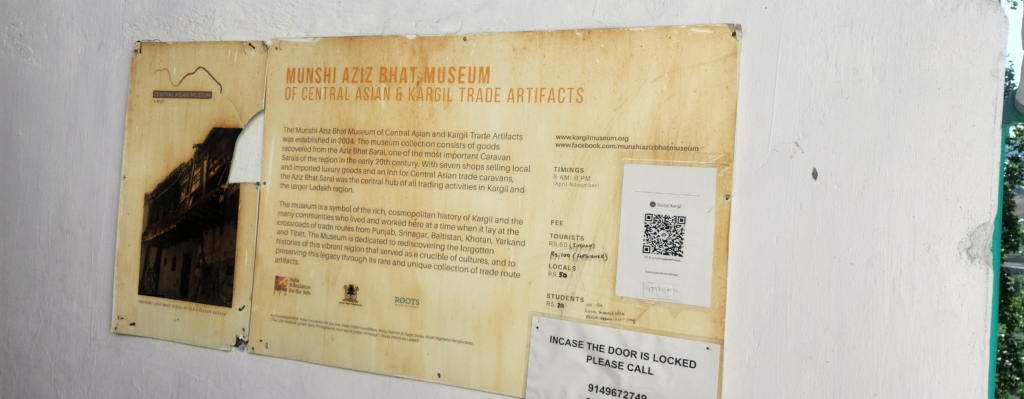
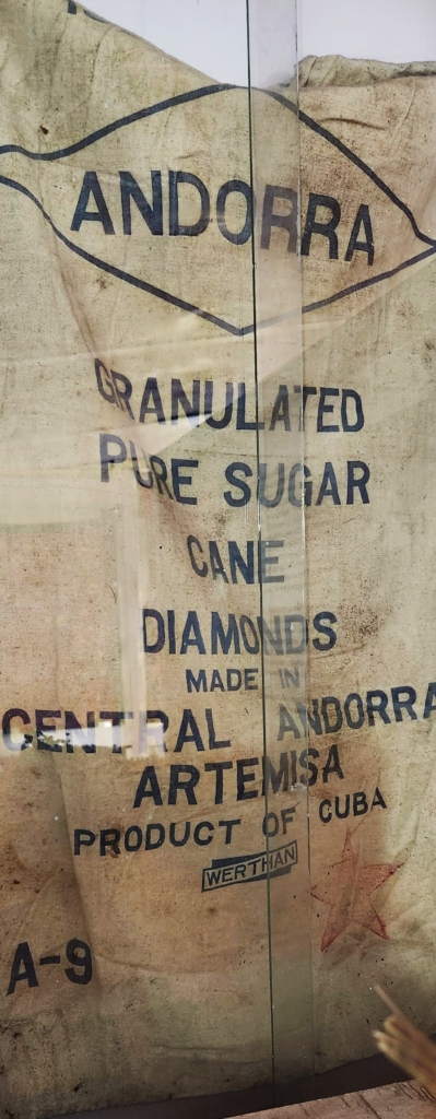
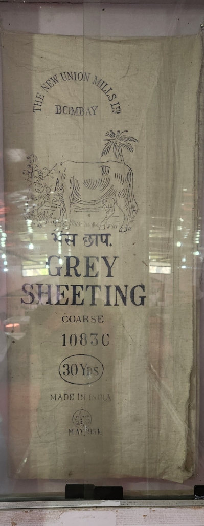
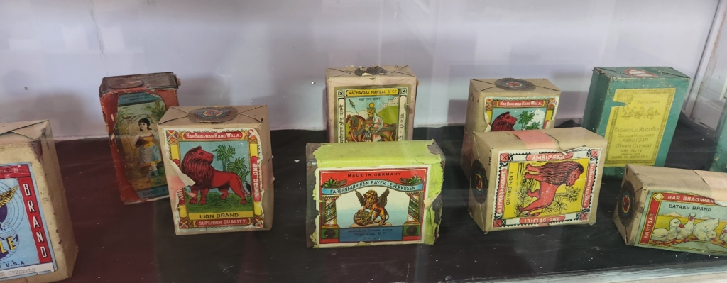
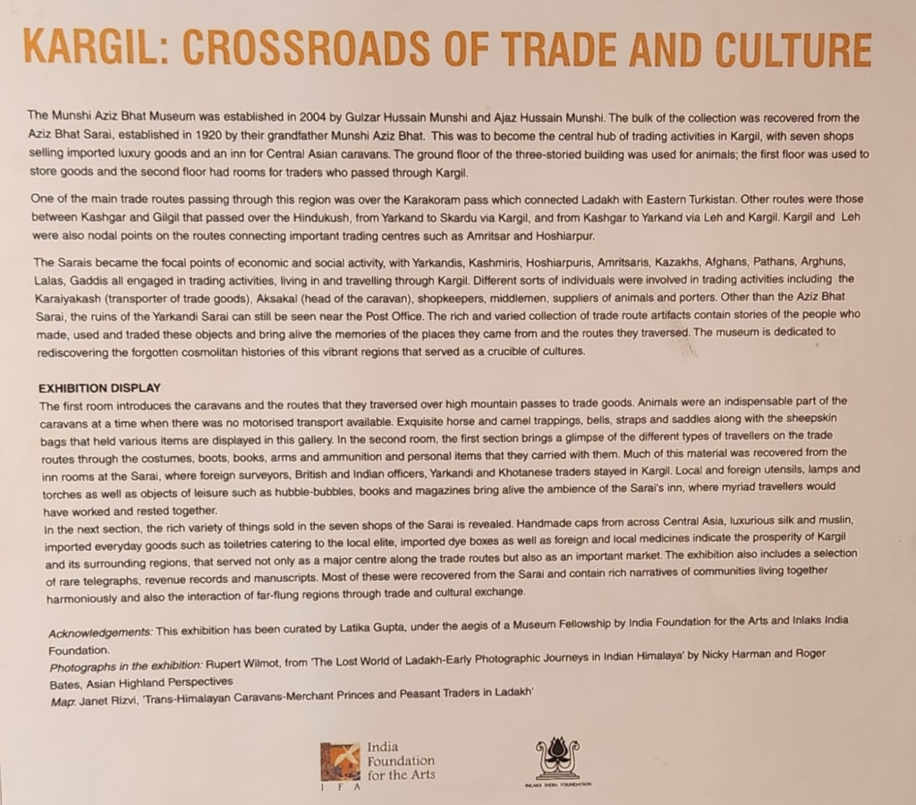
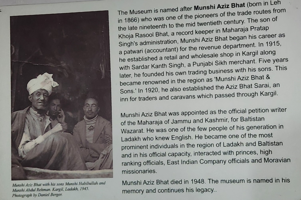
The local museum is named after Munshi Aziz Bhat, who was one of the most prominent individuals in the region of Ladakh and Baltistan having highly placed connections with kings / princes, East India Company officials and Moravian missionaries. He owned and operated several trading shops in Kargil and an inn – the “Aziz Bhat Sarai”, for traders and caravans which passed through Kargil.

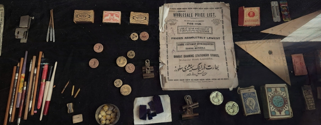
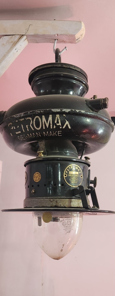
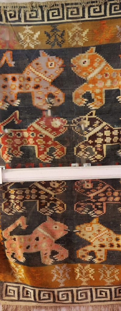
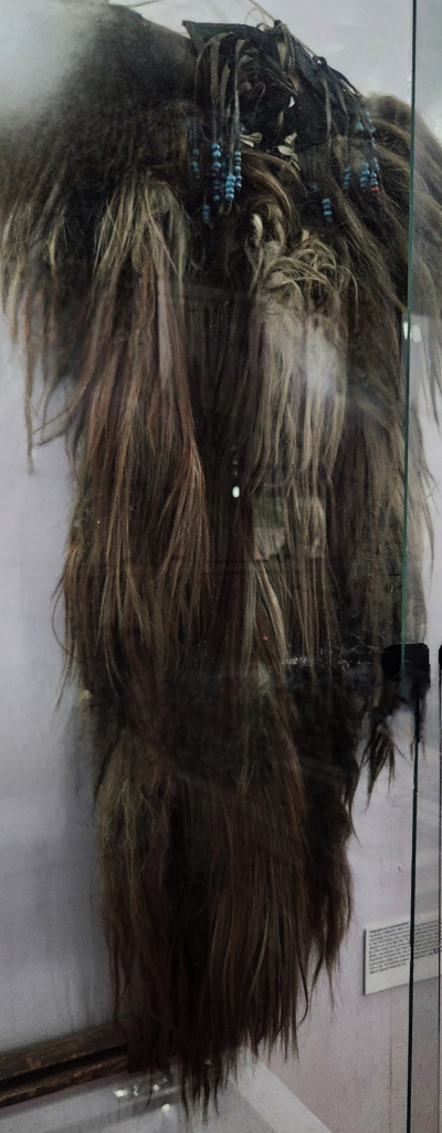
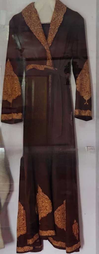
The museum is a symbol of the rich, cosmopolitan history of Kargil and the many communities who lived and worked here at a time when it lay at the crossroads of trade routes from Punjab, Srinagar, Baltistan, Khotan, Yarkand, and Tibet. The museum has a vast collections of clothes, daily use items, and various other artefacts used in the Ladakh region during early 18th / 19th century.

I was impressed by the collection put together which gave a glimpse of the lifestyle of the people in the Ladakh region. The museum collection narrated a story that inspite of remote location, Kargil / Ladakh thrived in midst of the global trade route – Silk Route. Goods from as far as Germany, Cuba, etc. had reached Ladakh.
Over my travel to several Indian border areas, I have realized that Silk Route was not just one specific trade route, it was a nomenclature used for any cross border trade route linking China and rest of the world. So we have multiple Silk Route(s) passing through Sikkim, Kashmir / Ladakh, etc. Places like Kargil, which served as a transit point, not only became a centre of trade but also a centre where knowledge got shared, travel stories from distant land got narrated and passed on. Most importantly, these cities like Kargil served as a melting pot for various culture to assimilate and enrich the local people.
Hostel was a short walk away from the museum. The small walk gave a brief glimpse of the town and it’s economy. Back at the hostel, we quickly got refreshed and packed our luggage to leave for our onward journey to Lamayuru via Batalik. As we were getting refreshed, Gopal our room mate requested if he could join us upto Lamayuru. We were delighted to have his company.

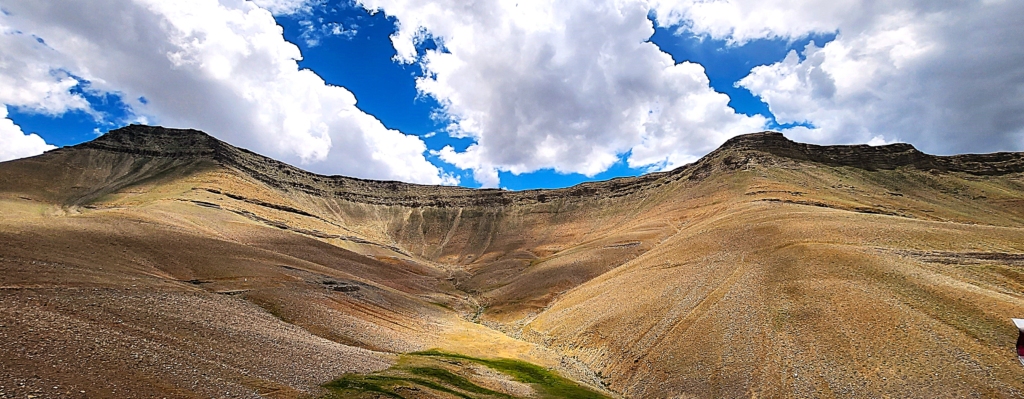
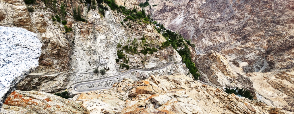
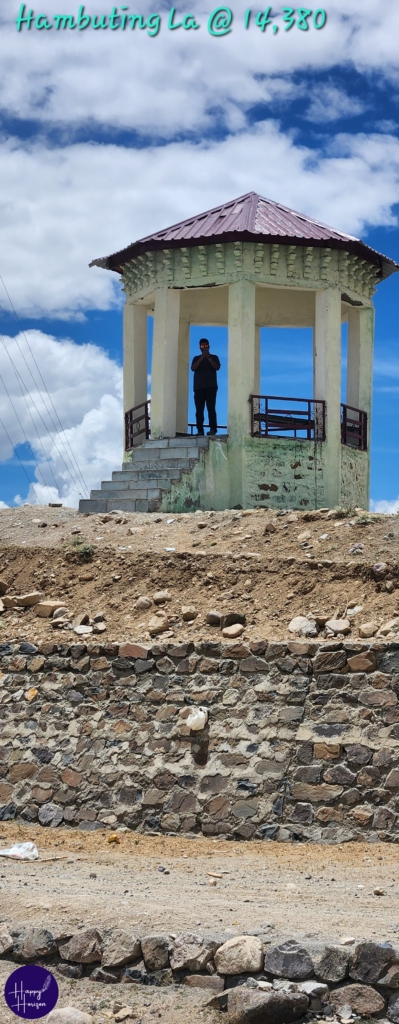
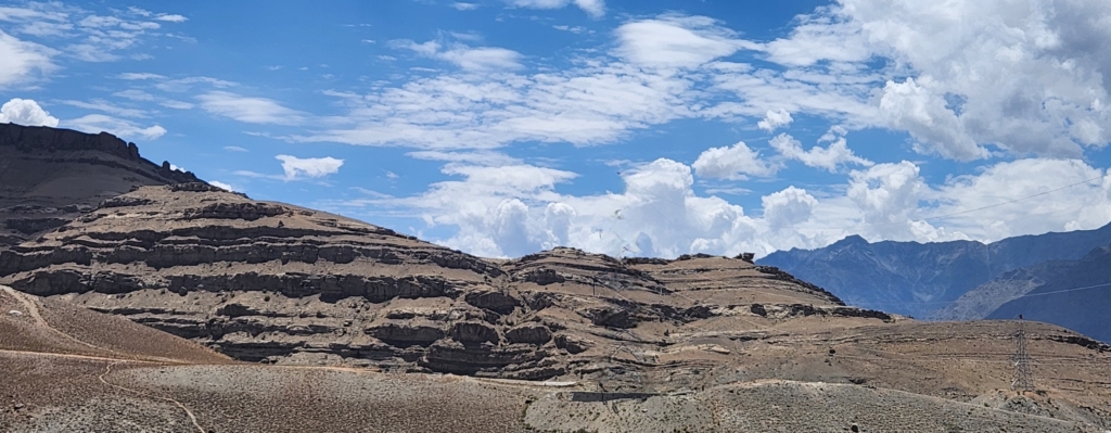
Hambuting La
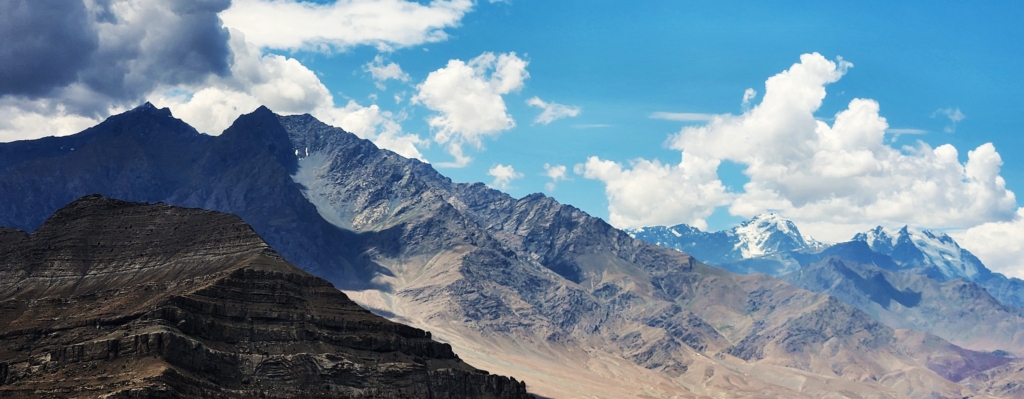
This route to Lamayuru via Batalik is significant due to its historical importance and proximity to the LOC. The first stop was Hambuting La, a gateway to Batalik. After steep drive, hairpin bends and passing through some of the amazing landscapes, we reached Hambuting La, at an altitude of 13,308 ft.


As I stood at Hambuting La overlooking the valley, surprisingly I remembered a trek I had done through Chandrakhani Pass near Manali, way-back in 1992 (Altitude of 12,180 ft.). I had completed Chandrakhani Pass after trekking for 5 days.
Chandrakhani Pass still remains my best travel experience. It was for the first time I was stepping outside Mumbai without close supervision of my parents. Its just like you can never forget your first love. We six college friends had decided to take this adventurous journey from Mumbai to Manali and trek up the pass. The trip has been historic with a collection of innumerable memories which we can still laugh over whenever we recollect the trip moments. More importantly it helped us to bond together over the years and be each others back bone in various aspects of life. I bet an interesting hilarious story waiting in queue to be written someday.


As we reached the Hambuting La, we found a middle-aged man lying in the shadow shelter of a milestone. As we spoke to him, I realized that he was a vagabond, clueless of where he had come from and where he was heading to. As we started to click photographs around milestone, he promptly gave us the space and also helped to click photographs of all three of us. Clearly he wasn’t disillusioned as we wanted us to believe. Maybe he did not want to share his story – a mystery of my trip.
Lalung & Silmo
We could see a small oasis of fertile land on the other side of the pass. As we drove down the village – Lalung, Danish found a small plank of wood fallen on the road. He stopped and picked it up, saying that it must have fallen off from a villagers truck. He said that it must have costed the villager and more importantly, someone must have carried it painstakingly from Kargil. Danish put one end of the plank on side rear view mirror and Gopal held the other end from the back seat. Further down the down, Danish noticed that a villager was constructing his house. We handed over the plank to the villager. He could not thank us enough. It just shows the clean heart of the people from the region.
The village of Lalung was lush green with stepped terrace cultivation. There were very few trees on the fields. Am sure there must have been a water stream somewhere, which was not visible along our route. It was a beautiful ride through the outskirts of the village.

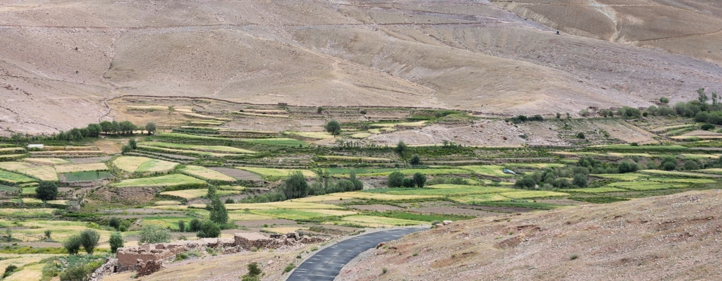
Lalung
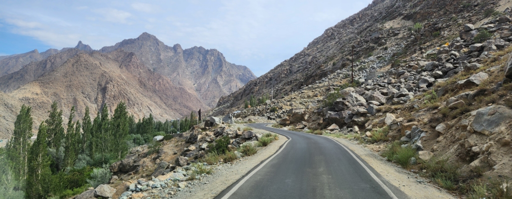
As we further drove down, we passed through another beautiful village – Silmo. The drive through this part of the country is very beautiful. The small road winds through the mountain with trees on either side of the road creating an arch, as if welcoming us. We were driving all along the LOC and these are small settlements along the LOC. At the corner village shop, Gopal and myself had some light hearted conversation with the shop owner Shabir and his friend, as Danish took a smoke break.


Shabir was quite excited to see me from Maharashtra. He had recently returned from a job stint in Aurangabad, Maharashtra. Shabir said that life in Silmo was quite different from Maharashtra and he was trying hard to adjust to it. Shabir’s shop hardly had any inventory as he had taken charge and opened the shop only few days back.
Shabir narrated the role of Batalik sector during the Kargil War. He and his friend narrated the spine chilling story of valour of Captain Manoj Kumar Pandey, who was posthumously awarded the Param Vir Chakra, the country’s highest gallantry award.
As we had combination of light and intense conversation with Shabir, I wanted to click his photograph. Initially, he was hesitant to get his photograph clicked, especially when I said I could possibly publish it on my web page. We teased him, if he was resisting because he was an absconding culprit from Maharashtra.
We all had a good laugh. At the end, he agreed and obliged me. I will surely remember him for his amazing sense of humour and his sense of responsibility towards his family to return back to Silmo. More importantly, for guiding through the history of Batalik and Kargil War stories.
Batalik
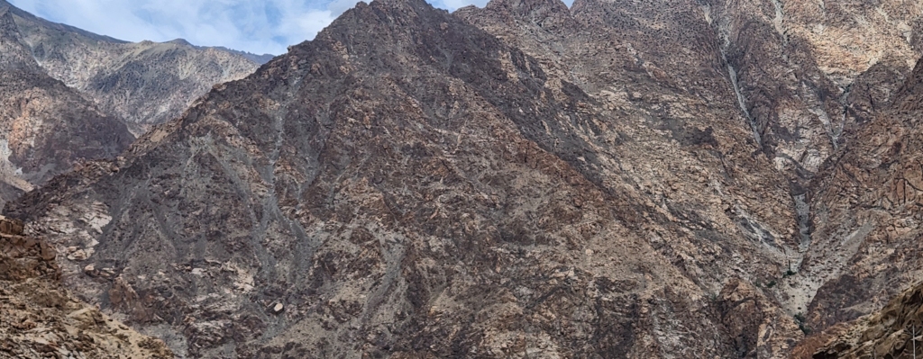
Batalik is a village and military base, close to the LOC. In Batalik, the LOC cuts across the Indus river between Batalik and Marol (POK). During Kargil War, the Pakistan’s soldiers had penetrated around 10 km. from the LOC to an unheld area in the East of Batalik. Pakistani soldiers had captured peaks varying in heights upto 16,800 ft.
Indian army was inducted to take charge of Batalik sub-sector to ensure that the enemy did not extend the intrusion to dominate the Leh–Batalik–Kargil Road and reclaim the lost land. Among the battles which were fought during Op. Vijay, the recapture of Khalubar Top in Batalik sector remains one of the key victories. As we passed through the jagged mountain peaks, we could only imagine how difficult it would have been for the Indian army to negotiate the extremely steep mountain slopes with sharp spine, especially with the enemy sitting comfortably at the mountain top in their bunkers.

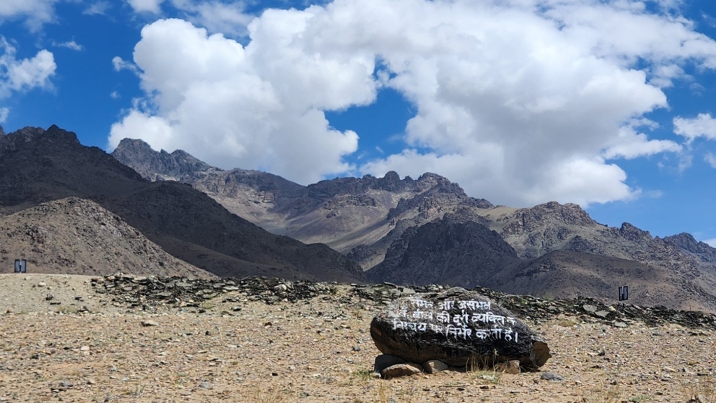
The inscription: “sambhav aur asambhav ke beechi ki doori vyakti ke nischay per nirbhar karti hai”, translates to – “Distance between possibility & impossibility depends on individual’s determination”.
What the Indian soldiers achieved in Kargil – Batalik sector is a prime example of “what seems unattainable or difficult can often be achieved with enough perseverance, effort, and willpower”. It’s not the inherent difficulty of a task that defines whether it can be done, but rather the level of commitment and resolve a person brings to overcoming obstacles.
In essence, the boundary between success and failure, or possibility and impossibility, is not fixed but can be shifted based on how determined someone is to reach their goal. Salute!!! Indian Army
Indus River
As we entered Batalik, I had first sighting of mighty river Indus. Indus had intrigued me since school days when we read about it in our geography lesson. In all honesty, one of the reason to travel to Ladakh had been to follow the Indus flow in India. I was doing so but in the opposite direction.
Ladakh has an extensive network of rivers, criss-crossing from one valley to another and merging with one another. Eventually all of them merge with Indus. The source of the Indus is somewhere close to Mount Kailash, Tibet. The river Indus enters India at Demchok, close to Hanle on India-China border and exits India in Batalik.

Indus river was known to the ancient Indians in Sanskrit as Sindhu. In all probability the name “India” is derived from Indus. “India” initially referred to those regions immediately along the bank of the Indus, where Punjab and Sindh (Pakistan) are now, commonly known as Indus Valley civilization. The word Punjab itself means “land of five rivers” – Jhelum, Chenab, Ravi, Beas and Sutlej, all of which finally flow into Indus. The water from these rivers serve as a life line for both India and Pakistan. The use of water by India and Pakistan from these rivers is covered under Indus Water Treaty.
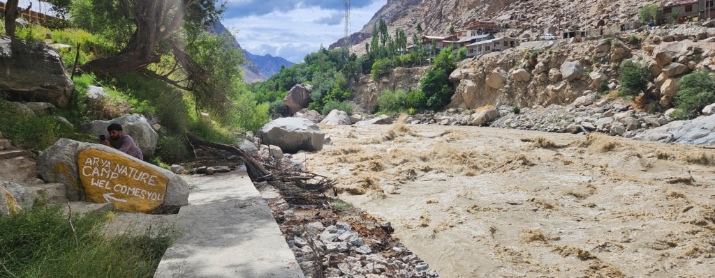
The flow of Indus was strong and created huge roar. The current is so strong, it can weaken the heart of even a gold-medal Olympian wrestler. Due to melting snow and monsoon season, the river was carrying heavy amount of silt, which had turned the colour of river water muddy brown.
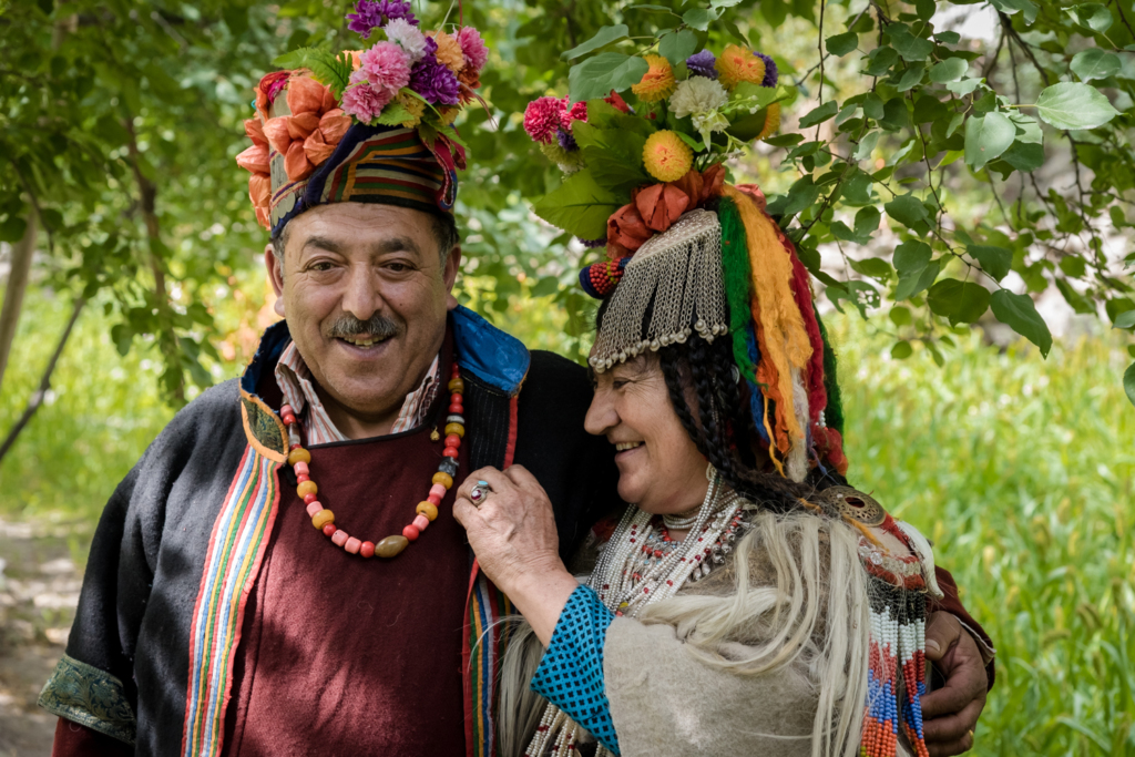
Darchik – the Red Aryan Village
The Brokpa are a small ethnic group living in the villages of – Darchik, Dah, Hanu and Garkon, claim to be the last of the “Aryans”. Shabir had said that some of them live in Silmo too. These villages are adjacent to each other on either side of the river Indus.

Frankly, I was lured by the “last Aryan village” tag, one of the main reason to choose this much longer route over the shorter / easier Kargil-Leh national highway via Lamayuru.
Among researchers there is a line of thought that the “Aryans of Ladakh” or the “Brokpas” might have descended from soldiers in Alexander’s army who had come to the region. From what I have read and inferred, “Aryan” is not a race but a culture, which assimilates many regional tribes into its fold, and is a sort of “best practices” collective historically.
I had read in various forums that women from various parts of the world travelled to this region with the specific goal to conceive children with Brokpa men, believing in the preservation of a pure Aryan gene within this community. As I had raised this question, Shabir had laughed whole-heartedly. He said, the entire region would have prospered, if that was indeed true.

Supposedly, the local tribes have a unique ornamentation style and interesting headgear that makes for great Insta pictures. We travelled through these villages quite extensively but could not find any trace of Brokpa men or women in their traditional head-gear attire. Although we had an amazing experience of the remotes of the region with Indus roaring along.
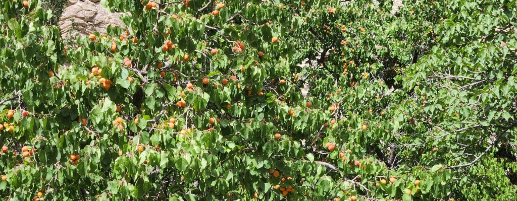
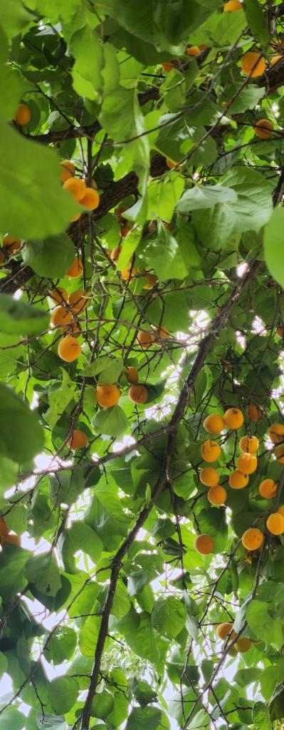
It was first time during the trip, we encountered Apricot trees laden with ripe velvet golden fruits. These villages had big Apricot orchards, which tempted us to pluck them for a taste, however, most of the trees were out of reach. It was way beyond lunch time and we were quite hungry. We stopped at couple of restaurants at each of these villages on the way for lunch, however, all of these restaurants had run out of stock for the day. We were quite surprised that they did not even have simple maggi to offer.
We stopped few tourist vehicles coming from opposite direction to figure out if there was any functional restaurant ahead. To our surprise even they were frantically looking for lunch. It was hilarious situation. That day I learnt my lesson the hard way – to have lunch on time.
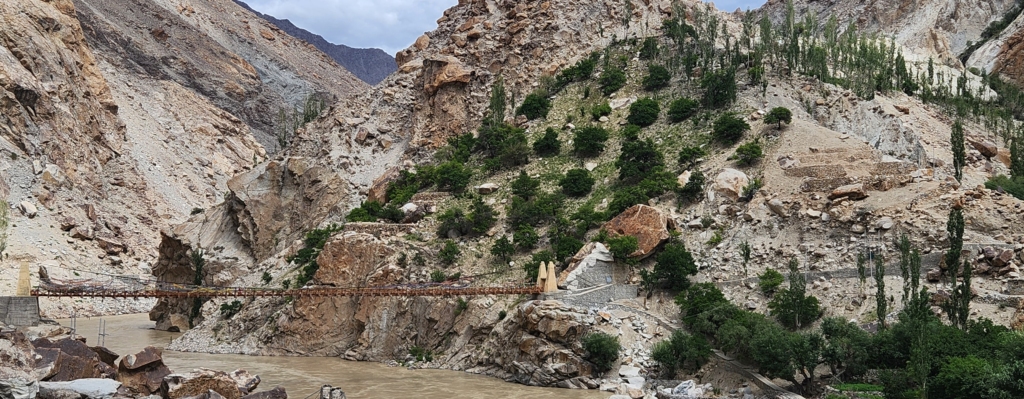
Lunch @ Garkone
Gopal’s mobile network suddenly sprung up to life. As we explored the map to find nearest village / restaurant, we figured out that Garkone, were we had stopped to explore lunch options, was the last village on the route for quite some distance forward.
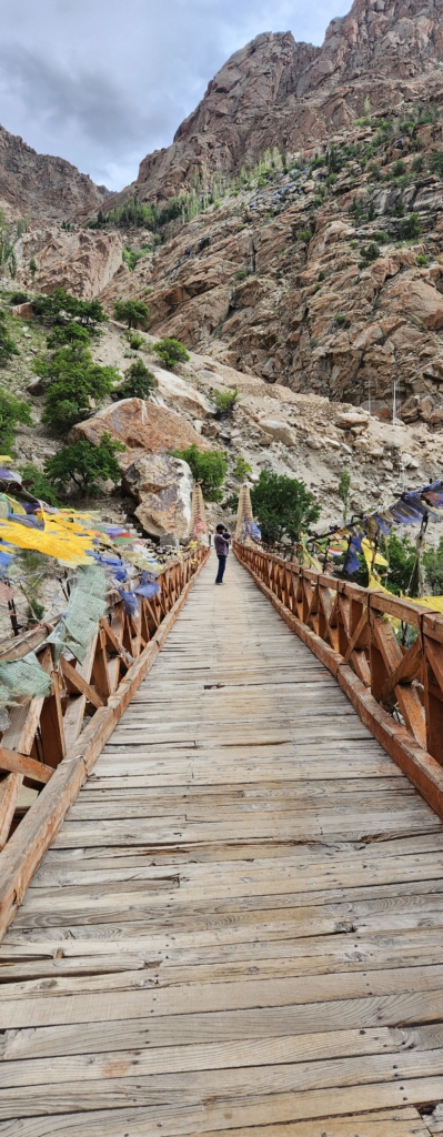


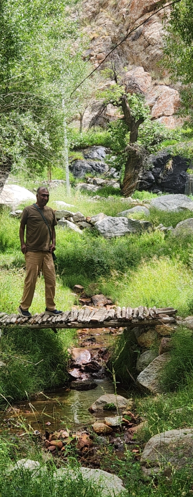
There was a resort across the river. Gopal called the resort to check if lunch was available. The cook answered the call and took pity on us and agreed to put together a simple lunch – dal and rice, if we could wait for half an hour. We agreed enthusiastically. We walked across the river through a long swinging bridge. With river Indus swirling below the bridge, it was a tensed walk across the bridge. The resort primarily served as a tent campsite for trekkers coming to the area. Sanjay, the cook was the only person holding the fort for the afternoon. All other employees were busy with afternoon siesta.

We parked ourselves under an apricot tree. While Sanjay was busy preparing our lunch, we savoured the ripe apricots to our satisfaction. The fruits were so soft, that we could break open them with a gentle squeeze with our two fingers. We had few apricots till we were satisfied. Sanjay and his team had plucked some riped apricot’s from the tree and put them out on a cloth to sun dry them. We tried few semi-dried apricots but nothing could beat the flavour of fresh fruit.
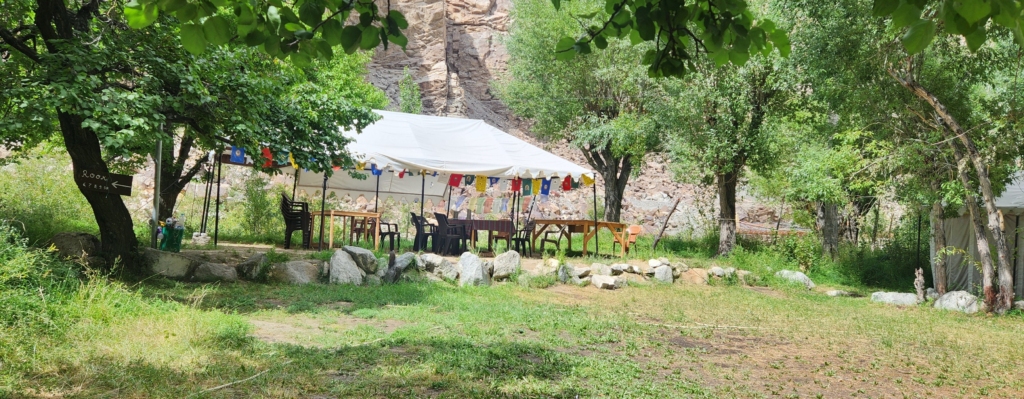
Sanjay took little more than half an hour to put the lunch together but we were not complaining. Gopal decided to help Sanjay to lay out the plates and ferry the food from kitchen to the garden. Probably, we had the best lunch of our trip on that day.


We could not thank Sanjay enough and tipped him well for sacrificing his sleep. As we walked out, a New Zealand couple walked in looking for food and shelter. Sanjay had mentioned that the region is quite popular amongst foreigners for treks along the nearby mountains.

With our tummy well taken care of, we started our drive towards Lamayuru.

Drive towards Lamayuru
The drive from Garkone to Lamayuru (via Achinathang and Takmachik) was quite long. Danish was visibly tired and we were still an hour away from Lamayuru. Indus was still flowing along with us. As we drove along, Takmachik village came on the other side of the river Indus. Takmachik is the first organic village of Ladakh, people in Takmachik village are fully organic since 2011 and termed as “eco-model” village. The village even from the other side of the river, seemed inviting with it’s pristine look and feel. However, we were running way behind our schedule and preferred to reach our stay before dark, so we decided to pass the village visit.


As we took the diversion towards Lamayuru, we found ourself stuck in a traffic jam, as the road had been damaged due to land slide because of heavy rains just a previous evening. Although we were lucky and the traffic cleared shortly.
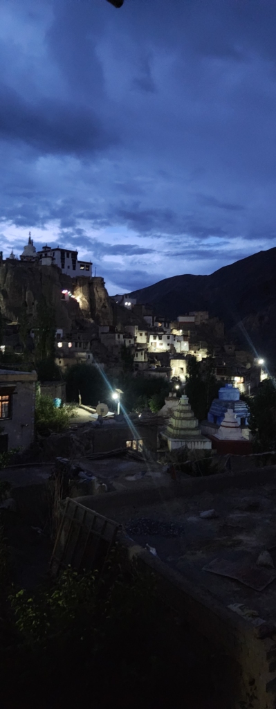
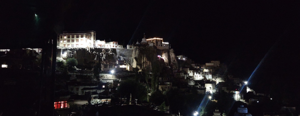
We reached our homestay at Lamayuru as it was just about to get dark. Gopal had booked himself in the same homestay. Tsewang, the home owner was waiting outside to receive us. From our bedroom, we could see the famous Lamayuru Monastery brightly lit.

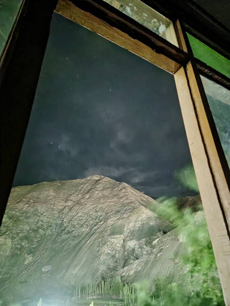
We were so tired that we all crashed for an hour. Tsewang woke us around 9 for dinner. There was just one more guest in the property. Danish was so tired that he went to sleep immediately after dinner. The other guest and Gopal came from software technology background. The discussion drifted towards artificial intelligence and it’s evolving role in our future life. After about 2 hours of discussions on various topics under the sky, we decided to bring out our camera gear and capture milkyway. The weather was chilly and my jacket was locked in the car. I did not feel like disturbing Danish. The sky was cloudy with partial visibility. So we decided to wrap up our photography session quickly and retire for the day. We all were tired and had a great sleep.


August 2024
If you’re planning a trip to Kargil or through Ladakh, we at HappyHorizon would be thrilled to curate your holiday plans to enhance your travel experiences. Feel free to reach out to us: connect@happyhorizon.in
Day 3: Lamayuru – Leh Sector – Read More
Gallery


Sukumar Jain, a Mumbai-based finance professional with global experience, is also a passionate traveler, wildlife enthusiast, and an aficionado of Indian culture. Alongside his career, which includes diverse roles in international banking and finance, he's working on a wildlife coffee table book and enjoys sculpture and pottery. His interests span reading non-fiction to engaging in social and global networking.