

Day 5 – 6 (Part 1): Turtuk & Hunder – Read More
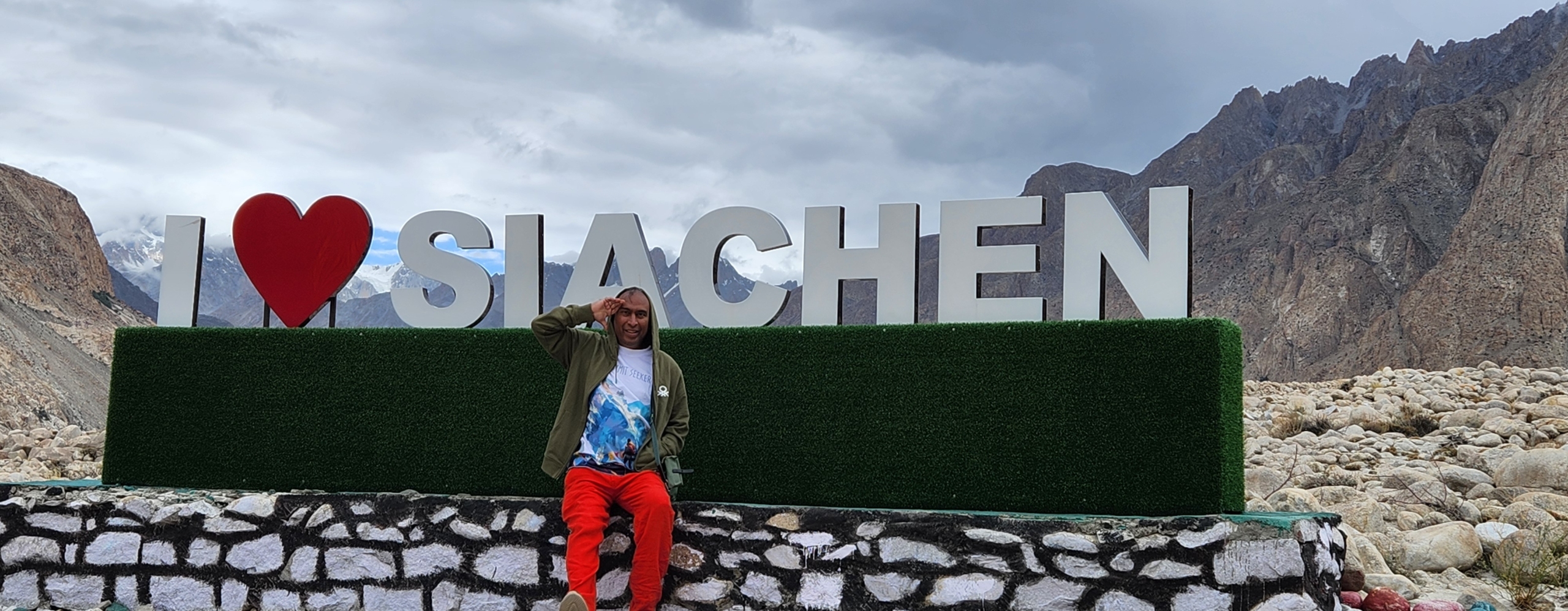
Day 6 (Part 2): Siachen
Khalsar – Panamik Hot Springs – Tongsteth: 87 km. / 2.30 hr. – Altitude: 10,400 ft (Panamik)
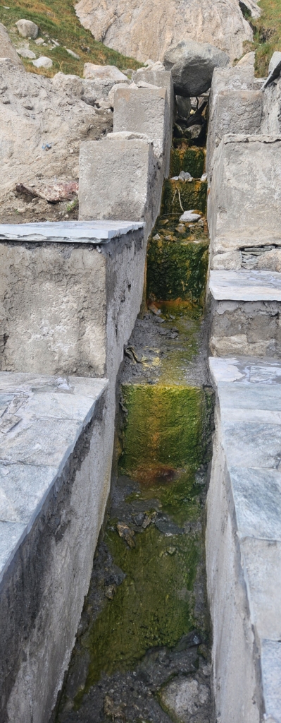
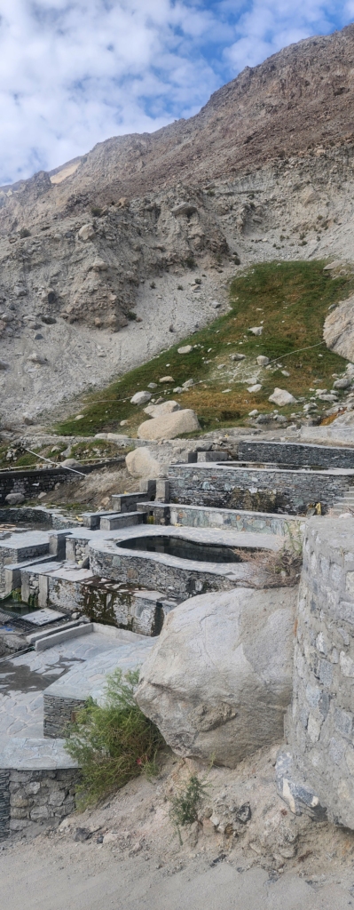
Panamik Hot Springs
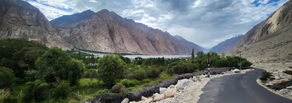
As soon as you turn from Khalsar towards Panamik (about 45 km. about an hour and half drive), you will be driving along Siachen / Nubra river. The road on this side of Nubra Valley is at an altitude rather than along the river level, so you really cant see the river all along the route but it’s just running along.

This part of Nubra Valley is Buddhist dominated, you will see prayer wheels at regular intervals as you pass the villages along the road. There are several boutique villages, like Terith, where you could spend the night if you don’t want to travel upto Siachen. Sumur is another place where there is a famous gompa. We could see many local tourists travelling on this route to visit the monastery. The monastery was not part of our trip, so we directly headed towards Panamik Hot Springs.

I was quiet surprised with the infrastructure the local authorities were putting together to make the hot springs a tourist spot. The water was flowing from the mountain just behind. The spring water was channelized to flow into a multi-level ponds, where you could dip your hands and legs. The water is boiling hot and it’s best advisable to test the water with your finger tips before immersing your hands / legs fully.

The fame of these hot springs had reached far corners of Kashmir. Danish’s maasi wanted couple of bottles of hot spring water. Maasi’s wish was Danish’s command. Danish immediately got busy collecting empty plastic bottles to carry spring water. I am not sure how couple of times application would really heal any infection or disease. But human’s are often driven by blind faith rather than logic.

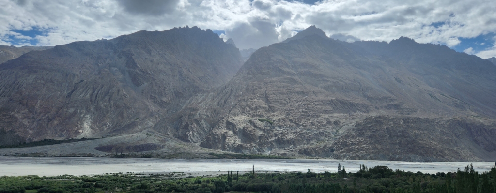
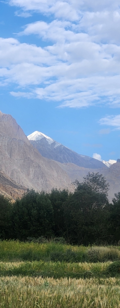
The panoramic view from the hot springs, lays out the bare nature in front, with Siachen river flowing silently along the Saltoro mountain range. These are some of the romantic natural views which one can sit in one corner and admire endlessly. All we need a hot cup of coffee and croissants.

Warshi
As we reached Warshi check-post, we were told that entry to Siachen Base Camp was closed for the day. The last entry beyond this point to visit Siachen Base Camp was before 4 pm. We were late by an hour. However, the guard allowed us to pass through as we were staying at Warshi. He warned us that we should not venture towards Siachen Base Camp, as there was risk of the river water swelling in the evening and evacuation would be difficult if the weather turned bad. We had followed all security related instruction during our travel and we intended to comply here the same.
Note: The foreign (non-Indian citizens) tourists can travel upto Warshi security check-post but there are no organised stay arrangements beyond Panamik.
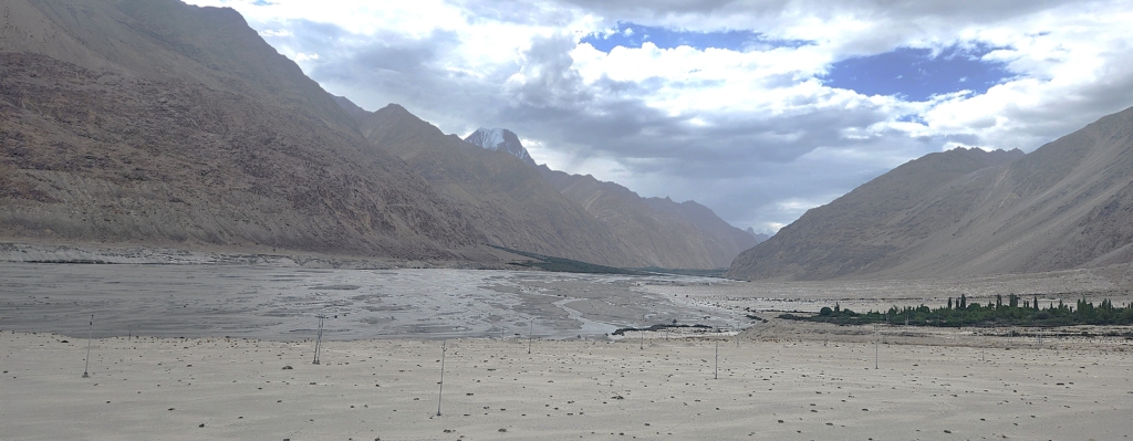
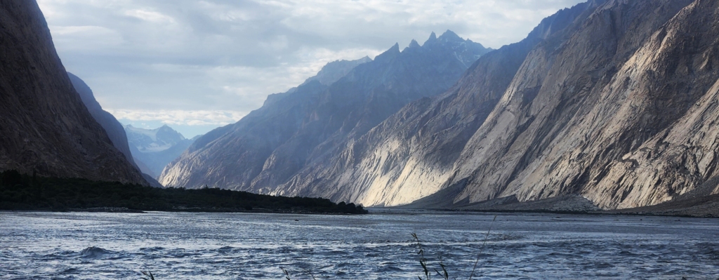
As we crossed the check-post, the topography started to change. We had descended to river flow level, with Saltoro mountain range coming closer to us on the left and lower reach of Karakoram mountain range on the right. We were driving through some of the most historic path of Old Silk Route.

Tongsteth
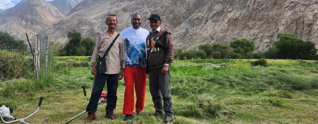
Lotus, our host for the night was following our movement every hour from Khalsar to ensure we did not miss the turn-off from the main road to reach his village Tongsteth (few km. before Warshi). As we closed in to the landmark, Lotus said that he would wait for us on the main road near the diversion.
I was busy admiring the nature unfolding in front of me. Danish suddenly slowed down, wondering if we heard someone whistle. Since I had not heard the whistle and we could not see anyone, I presumed it was some birds chirping. Danish was pretty sure it was a human whistle. As we retraced our car back slowly, we saw Lotus running and waving to us. We had clearly missed the nondescript diversion. It was Danish’s presence of mind that probably saved us an hour. Probably, there are merits of driving along with a seasoned driving professional.
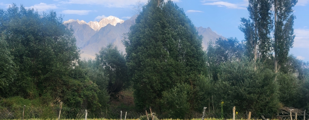
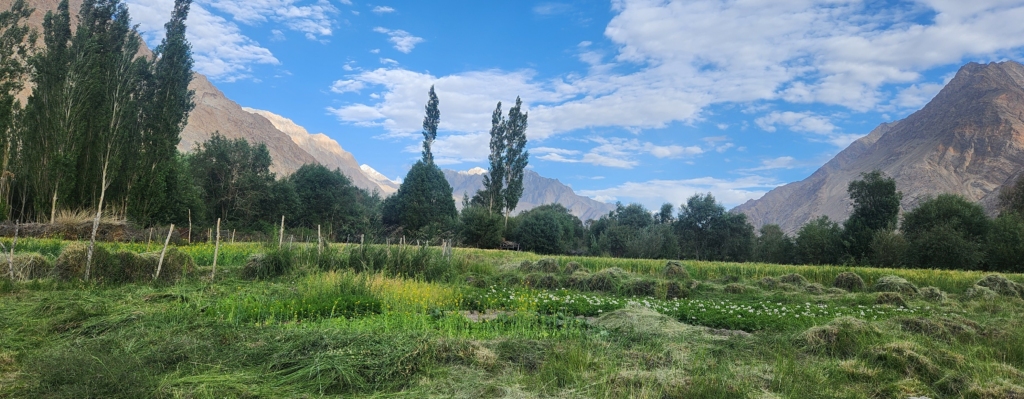
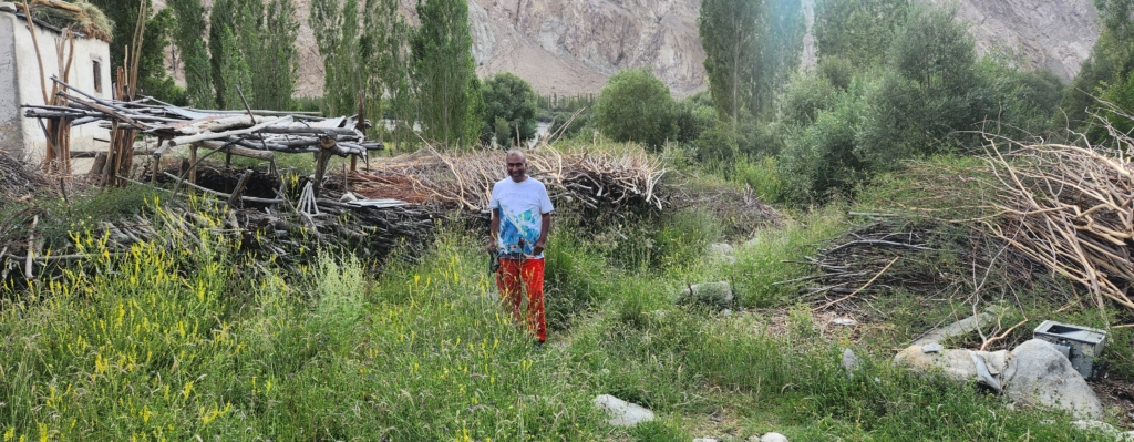
Lotus said laughingly that technically the nearest civilian settlement closest to Siachen is the village of Warshi, which only has one dilapidated house with just one person staying intermittently. For all practical purpose Tongsteth is the nearest civilian settlement closest to Siachen Base Camp. Lotus house is set in one of the most picturesque environment one can imagine. Its just like the painting we all used to draw as a child. A small house by the river with fields and mountains nearby. The sun shinning brightly and birds chirping nearby. The most peaceful and content life one can imagine. The air was blowing mildly carrying the blended fragrance of the snow, wet silt and flowers. It was a dream come true for me.
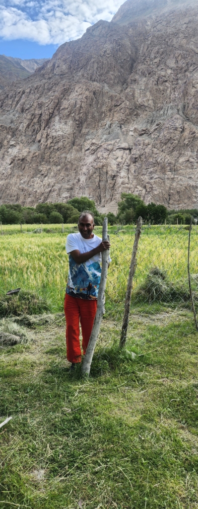
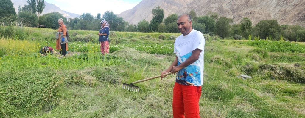
After having a hot cup of tea, Lotus and myself decided to go for a walk around the village along the river. Lotus extended family owned a substantial portion of agricultural land surrounding his house upto the river. The household members were tendering to the fields. The population in the village was probably a handful of families. As we met some of Lotus extended family members on our way, it was difficult to put an age number on any of them. They were fit and sturdy. Even a wild guess would be way off the mark. I also picked the fork hoe and extended my helping hand to the ladies in the fields. As we walked along the fields, Lotus showed his ancestral home, which was beautiful and elegant in architecture. His parents currently stay in the old house. I envy them.

The Siachen / Nubra river was flowing rapidly. The river was formed due to melting snow from the Siachen Glacier. Lotus explained that “Sia” in the Balti language refers to the rose-family plant widely dispersed in the region. “Chen” refers to any object found in abundance. Thus the name Siachen refers to a land with an abundance of roses.

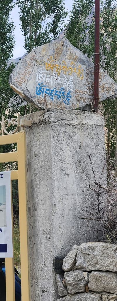
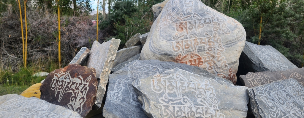
Lotus and his wife shared all the responsibilities equally. Lotus wife primarily managed the fields and Lotus managed everything else. Lotus is an ardent religious man, following tenets of Buddhism. He has sculpted various stones with Buddhist hymns. He offered to choose any of the sculpture as a gift, however due to their weight, I had to politely refuse it.
Lotus is skilled sculptor, electrician, architect, etc. A compact handyman with all skills rolled in one. Lotus humbly submits that necessity is the mother of all learnings. Since, the village is very far away from civilization, it takes a week if not more before any mason help can be procured. Therefore rather than waiting endlessly for the help to arrive, he has learnt all the trades himself on the job. He laughs again and confess that he has a bad reputation amongst the masons. He adds that the young masons are not skilled enough and he cannot resist correcting them. He cant see them doing wrong especially if they are constructing his house. He admits that he is getting old and cannot manage all the work himself. He needs helping hands.
As we discussed about the famous Siachen Base Camp, Lotus said that he used to work as a porter with the Indian army. He had led supplies to army camp several times through the challenging terrains up to Kumar Post at an altitude of 15,000 ft. Kumar Post is a logistics sub-base of Siachen Base Camp, which is about 60 km. a 9-day return trek from Siachen Base Camp towards Indira Col with temperature falling below -50 degree Celsius. Although he had himself not been to Indira Col. He said that the temperature up there could even fall down up to -85 degrees. These temperatures are just unimaginable.


Post dinner, we tried to capture the milkyway, with little success. Danish and myself were too tired and decided to sleep in early. We had to start early the next day as we had to first cover Siachen Base Camp and then travel all the way to Merak. We were hoping that the route along Shyok river would open but mentally we were prepared for the long haul to Merak via Leh.


Lotus offered to put together breakfast for us at 6 am, however we politely requested him not to take the trouble so early in the morning.
Day 7 (Part 1): Siachen Base Camp
Tongsteth – Siachen Base Camp: 30 km. / 1 hr. / Altitude: 12,300 ft. (Siachen Base Camp)
To our surprise, Lotus was up and ready with tea before we got out of bed. His wife had already left for the fields. He guided us the way towards the Base Camp. He warned us that we would be the only people on the road so early. The ride from Tongsteth to Siachen, driving along Siachen river, is very scenic.


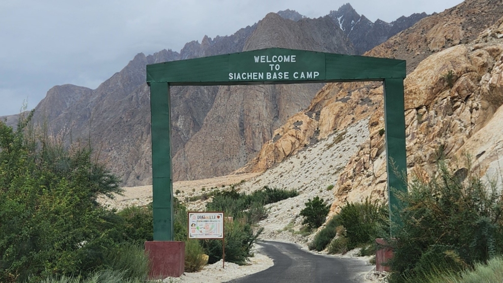
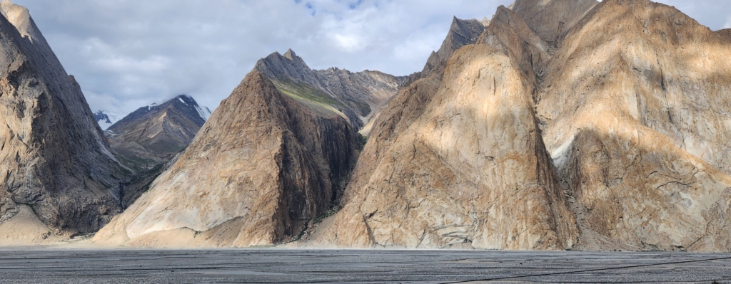
Siachen Base Camp is at the altitude of 12,300 ft. The army at the Base Camp has been put up together to defend the entire Siachen Glacier and 110 km. long Actual Ground Position Line (AGPL). AGPL starts from Point NJ9842 and goes north upto Indira Col forming the de-facto border with POK. Currently, Indira Col is the northernmost point of India.
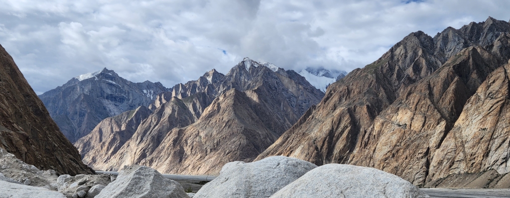
The Siachen Glacier is located just north-east of the Point NJ9842. Siachen Glacier along with all its associated glaciers, is spread over 700 sq km. It is the second longest glacier in the world outside the polar areas. Therefore, the Siachen Glacier is sometimes referred as the “Third Pole”. The glacier lies between the Saltoro Ridge to the west and the main Karakoram range to the east. The Saltoro Ridge (altitude ranging from 17,880 ft. – 25,330 ft.) originates in the north from the Sia Kangri peak.
The geographical importance of Siachen can be well understood, as you follow the directions marked on a semi-circular wall at Siachen Base Camp. From left (west) to right (east):
Point NJ9842 is at a distance of 25 km. – Gilgit Region (POK): 27 km. – Mt. K2: 102 km. – Mt. Sia Kangri: 68 km. – Indira Co: 70 km. – Karakoram (KK) Pass: 42 km. – China border: 45 km.


Mt. K2 lies within the Karakoram range, at an altitude of 28,244 ft. it is the world’s second highest peak after Mt. Everest. It currently lies in POK. Karakoram means “black gravel” in Central Eurasian language. The policy of the Great Trigonometrical Survey of India was to use local names for mountains wherever possible. Where the local names for the Karakoram peaks were not known, they were labelled with numbers, which extends up to more than thirty, where “K” stands for Karakoram. “K1” was found to be known locally as Masherbrum. “K2”, however, appeared not to have acquired a local name, possibly due to its remoteness.

Sia Kangri is a mountain peak in the Karakoram range with an altitude of 24,350 ft., and lies within POK.

Indira Col is about couple of km. eastwards from Sia Kangri. A “Col” in geomorphology is the lowest point on a mountain ridge between two peaks. Indira Col is at an altitude of 18,875 ft. and is located on the Indira Ridge in the Siachen Muztagh (sub-range) in the Karakoram Range.

Karakoram Pass was India’s gateway from Central Asia. The Silk Route through this pass was used by trade caravans. India can hold and control Karakoram pass only and only if Saltoro ridge is firmly in India’s hands. This is one reason that perhaps is the most important reason for holding Saltoro ridge.
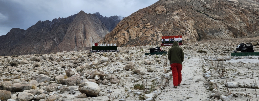
The entire experience of standing at the Base Camp overlooking the vast Siachen Glacier was very surreal. We could see snow covered mountains at the far end and Siachen River coming along. It was difficult to guess where the snow-line melted and from where did the river start.
Tucked away in the quiet remoteness, we stumbled upon a little café, nestled in a humble tin-shed and run by a friendly local. Fortune smiled upon us as it was open, and we indulged in the simple yet delightful breakfast – steaming hot Maggi noodles and a perfectly spiced omelette, paired with a cup of piping hot ginger tea. In this isolated corner of the world, it felt like pure luxury.
Before departing, I wandered to a nearby army-run outlet that had just begun to open its doors. There, I picked up a few souvenirs – small tokens to remember this hidden gem of a place.
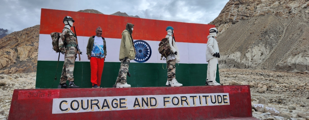
With our appetites satisfied, we took a moment to pause and immerse ourselves in the serene yet powerful atmosphere around us. The sheer grandeur of the landscape only deepened our appreciation for the unwavering sacrifices made by the Indian Army to safeguard the nation. As we prepared to depart from the Siachen Base Camp, we paid our respects at the solemn memorial dedicated to the martyrs – a poignant reminder of their courage and selfless devotion.
As we travelled back towards Leh, Bob Dylan song echoed:
How many deaths will it take till he knows
that too many people have died?
The answer my friend,
is blowing in the wind.
The answer is blowing in the wind.
These lines, from Bob Dylan’s song “Blowin’ in the Wind,” reflect a powerful and poetic commentary on human suffering, particularly in the context of war, violence, and injustice. The question – “How many deaths will it take till he knows that too many people have died?” – asks when humanity will finally recognize the unacceptable loss of life and the futility of continuing down destructive paths.
Overall, the lines evoke a sense of moral urgency, highlighting the need for greater awareness and action against ongoing suffering.
The answer, “blowing in the wind,” suggests that the solution is elusive, yet it’s also ever-present and possibly simple. It could imply that the truth is obvious, like something carried on the wind, but people fail to grasp it. The wind represents both the fragility of life and the fleeting nature of answers that are within reach but often ignored.
August 2024
If you’re planning a trip to Siachen Base Camp or explore Ladakh, we at HappyHorizon would be thrilled to curate your holiday plans to enhance your travel experiences. Feel free to reach out to us: connect@happyhorizon.in
Day 7 (Part 2): Merak (Pangong Tso) – Read More
Gallery


Sukumar Jain, a Mumbai-based finance professional with global experience, is also a passionate traveler, wildlife enthusiast, and an aficionado of Indian culture. Alongside his career, which includes diverse roles in international banking and finance, he's working on a wildlife coffee table book and enjoys sculpture and pottery. His interests span reading non-fiction to engaging in social and global networking.

